

.png)
How Drone Property Surveys Are Revolutionizing Property Assessment
- capturenow360
- Jan 26
- 4 min read

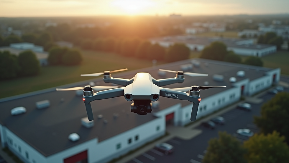
When it comes to property assessment, accuracy and efficiency are everything. Traditional methods often involve manual inspections, ground surveys, and time-consuming data collection. But what if there was a way to speed up the process, reduce errors, and gain a comprehensive view of a property in minutes? That’s where drone property surveys come in. These high-tech tools are transforming how we assess properties across real estate, construction, retail, and manufacturing sectors worldwide.
Let me walk you through how drone property surveys are changing the game, why they matter, and how you can leverage them to get ahead.
Why Drone Property Surveys Are a Game-Changer
Imagine trying to inspect a sprawling industrial site or a complex retail park on foot. It’s slow, labor-intensive, and sometimes risky. Drone property surveys solve these problems by providing a bird’s-eye view that’s both detailed and fast.
Here’s why they stand out:
Speed: Drones can cover large areas in a fraction of the time it takes a human surveyor.
Accuracy: Equipped with high-resolution cameras and sensors, drones capture precise measurements and images.
Safety: No need to send people into hazardous or hard-to-reach areas.
Cost-Effectiveness: Less manpower and fewer hours translate to lower costs.
Data Richness: Drones collect data that can be processed into 3D models, orthomosaics, and thermal maps.
For example, a construction company can use drone surveys to monitor site progress weekly, ensuring everything stays on track without disrupting work. Retail businesses can assess parking lots and building exteriors quickly to plan maintenance or expansions. Manufacturing plants can inspect roofs and large equipment safely and efficiently.
How Drone Property Surveys Improve Data Collection and Analysis
One of the biggest challenges in property assessment is gathering reliable data. Traditional surveys rely on manual measurements and visual inspections, which can be subjective and prone to human error. Drone property surveys bring objectivity and precision to the table.
Drones capture thousands of images and sensor readings during a flight. These raw data points are then stitched together using specialized software to create:
3D models that provide a realistic representation of the property.
Orthomosaic maps that offer accurate, scaled aerial views.
Thermal images to detect heat leaks or electrical issues.
Topographic maps for land elevation and contour analysis.
This rich dataset allows professionals to analyze properties in ways never before possible. For instance, a real estate developer can evaluate terrain slopes and drainage patterns before breaking ground. A manufacturing facility manager can spot roof damage or insulation problems early, preventing costly repairs.
The best part? These insights come faster and with less hassle than traditional methods.
Practical Applications of Drone Property Surveys Across Industries
Drone property surveys are not just a novelty—they deliver real, measurable value across multiple sectors. Here’s how different industries benefit:
Real Estate
Property Valuation: Detailed aerial images help appraisers assess land and building conditions more accurately.
Marketing: Stunning aerial photos and videos enhance property listings, attracting more buyers.
Due Diligence: Developers can inspect sites remotely before purchase decisions.
Construction
Progress Monitoring: Weekly drone flights track construction milestones and identify delays.
Site Safety: Drones inspect hazardous zones without putting workers at risk.
Quality Control: High-resolution images reveal defects or deviations from plans.
Retail
Facility Management: Regular drone surveys monitor parking lots, rooftops, and signage.
Expansion Planning: Aerial data supports site selection and layout optimization.
Security: Drones provide surveillance capabilities for large retail complexes.
Manufacturing
Asset Inspection: Drones check equipment, storage tanks, and infrastructure.
Energy Efficiency: Thermal imaging identifies heat loss and electrical faults.
Environmental Compliance: Aerial surveys monitor waste disposal and emissions.

How to Integrate Drone Property Surveys Into Your Workflow
Adopting drone property surveys might seem daunting, but it’s easier than you think. Here’s a step-by-step approach to get started:
Identify Your Needs
What are your main goals? Is it faster inspections, better data, or cost savings? Clarifying this helps tailor the drone survey approach.
Choose the Right Drone and Software
Not all drones are created equal. Look for models with high-resolution cameras, GPS, and compatibility with mapping software.
Train Your Team or Partner with Experts
You can either train in-house staff or hire professional drone survey providers. The latter often offers faster deployment and expert analysis.
Plan Your Survey Flights
Define flight paths, altitudes, and data capture parameters to ensure comprehensive coverage.
Process and Analyze Data
Use specialized software to convert raw images into actionable insights like 3D models or thermal maps.
Apply Insights to Decision-Making
Use the data to improve property valuations, monitor construction progress, or optimize facility management.
By following these steps, you can seamlessly integrate drone property surveys into your existing processes and start reaping the benefits immediately.
The Future of Property Assessment with Drone Technology
The rise of aerial drone surveying is just the beginning. As drone technology advances, expect even more sophisticated tools like AI-powered image analysis, real-time data streaming, and autonomous flight capabilities.
Imagine a future where you can:
Get instant property assessments from your smartphone.
Automatically detect structural issues before they become costly.
Visualize entire sites in immersive 3D environments for better planning.
For businesses aiming to stay competitive, embracing drone property surveys is not just an option—it’s a necessity. The technology aligns perfectly with the goal of delivering immersive digital experiences and precise spatial data, helping you manage your assets smarter and faster.
If you want to lead in your industry, now is the time to explore how drone property surveys can transform your property assessment processes.
Taking the Next Step Toward Smarter Property Assessments
Ready to upgrade your property assessment strategy? Start by exploring drone survey providers who understand your industry’s unique needs. Look for partners that offer:
Customized survey solutions.
Fast turnaround times.
Comprehensive data analysis.
Support for global operations.
Remember, the goal is to gain clearer insights, faster results, and better decisions. Drone property surveys deliver all three, making them a powerful tool for any business managing real estate, construction, retail, or manufacturing assets.
Don’t let outdated methods hold you back. Embrace the future of property assessment with drone technology and watch your efficiency and accuracy soar.
By integrating drone property surveys into your workflow, you’re not just adopting new technology—you’re transforming how you see and manage your properties. The sky is literally the limit.


Comments